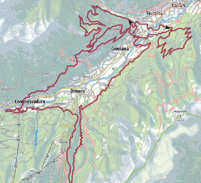

67 km and 3300 mt of elevation gain
It is a real epic experience that from this year can be run across as a RELAY COUPLE.
Web page will be update shortly
The organizing committee reserves the right to make any changes to the provisional track indicated, if necessary. The route is open from the beginning of June (except for the crashes of plants and snow at high altitude) the signs with yellow ribbons and arrows will be set up by June 15.

Race description:
Special timed uphill section:
Special timed downhill section on the “Sentiero da Gac” single track:
FEED ZONES:
Along the course, there will be 4 feed zones for athletes feeding, fruits, biscuits and drinks avaiable for free.
CHECK POINTS:
Along the course, there will be 3 check point for checking the CHIP, riders that will not be checked will be disqualified.


